Currently a one-man band
We'll see what the future holds....
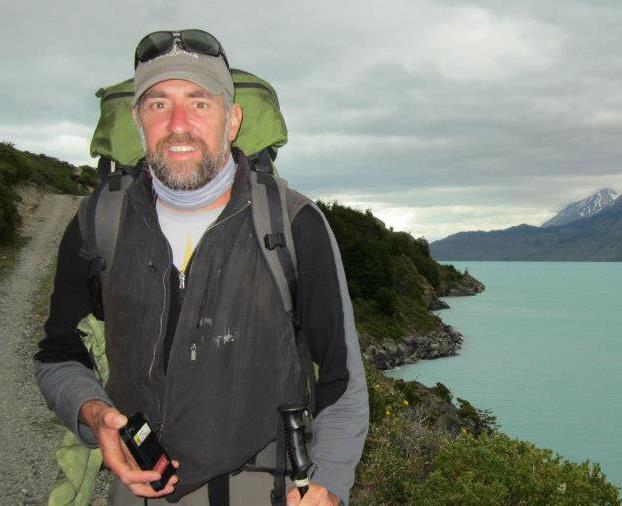
Michael Miller: CEO and lead developer
"One final paragraph of advice: do not burn yourselves out. Be as I am — a reluctant enthusiast... a part-time crusader, a half-hearted fanatic. Save the other half of yourselves and your lives for pleasure and adventure. It is not enough to fight for the land; it is even more important to enjoy it. While you can. While it’s still here. See more... So get out there and hunt and fish and mess around with your friends, ramble out yonder and explore the forests, climb the mountains, bag the peaks, run the rivers, breathe deep of that yet sweet and lucid air, sit quietly for a while and contemplate the precious stillness, the lovely, mysterious, and awesome space. Enjoy yourselves, keep your brain in your head and your head firmly attached to the body, the body active and alive, and I promise you this much; I promise you this one sweet victory over our enemies, over those desk-bound men and women with their hearts in a safe deposit box, and their eyes hypnotized by desk calculators. I promise you this; You will outlive the bastards." - Ed Abby See less...
OBJECTIVE
To find a way that I can effectively utilize my GIS, spatial analysis and programming skills to serve the conservation community in general and in Latin America in particular.
KEY STRENGTHS
GIS Analyst and Application Developer in the Energy, Utilities, Oil and Gas, and Natural Resources sectors.
- QGIS, PostGIS, ArcGIS Desktop, ArcGIS Server, 3D Analyst, Spatial Analyst, and ArcGIS Online.
- Programming in VB.NET, ArcObjects, Python, MS Access
- Integration of GIS and Relational Databases
- Development of flexible, customized, mobile data collection systems using Leaflet, Turf, and PostGIS
- Development of secure client portals to your data.
- Implementation and use of Trimble, TopCon, Magellan, and Garmin GPS
- Web Development with Javascript, jQuery, PHP, PostgreSQL, MySQL, Leaflet
- Statistical Analysis using R, SPlus, and SAS
- Complete software development cycle including documentation and training
- 12 years in the environmental consulting field
- More than 25 years experience with GIS
- More than 35 years experience programming and using of Relational Database Management Systems
1990-1994 Montana State University
B.S. Wildlife Biology
1995-1998 Colorado State University
M.S. Graduate Degree Program in Ecology
Thesis: Ecology of deer mice (Peromyscus maniculatus) and Ord's kangaroo rat (Dipodomys ordii) in riparian zones of regulated versus unregulated rivers in northwestern
2000-2003 Purdue University
PhD. (Incomplete) Forestry - Quantitative Analysis Emphasis
Dissertation (Incomplete): Statistical inference from continuous movement trajectories: What do we do with GPS collar data?
TEACHING
| Year | Course | Institution |
| 1993 | Seed Plant Identification | Montana State University |
| 1994 | Seed Plant Identification | Montana State University |
| 1994 | Mammalogy Lab | Montana State University |
| 1996 | Design of Wildlife Projects TA | Colorado State University |
| 2001 | Herpetology Lab | Purdue University |
| 2002 | Quantitative Methods in Ecology TA | Purdue University |
| 2003 | ArcObjects Programming for Ecological Applications* | Purdue University |
| 2012 | Extending ArcGIS with ArcObjects for ArcGIS 10* | Geospatial Training Services |
| 2017 | Introduction to Web Programming for GIS Applications* | Udemy |
* indicates a course that I developed from scratch.
PROFESSIONAL
2011-2017
Miller Mountain LLC
Lead Developer and CEO
- Developed course "Introduction to Web Programming for GIS Applications
- Developed Dirtbag Database, a user updateable record of inexpensive camping
- Developed Soil Analyst: an ArcGIS Add-in for working with NRCS SSURGO Soil data within ArcGIS
- Developed a custom application for extracting and reporting geospatial data for fulfilling the requirement for NEPA documents for gas wells on BLM land in NW New Mexico.
- Developed course “Extending ArcGIS with ArcObjects and .NET for ArcGIS 10”
- Analysis of data and creation of map products for BIA range assessment projects on the Navajo Indian Reservation
- Developed custom geoprocessing toolbox using Python to support range assessment analysis
- Created mapbooks including over 1000 maps.
2014-2016
OtterTail Environmental Inc.
GIS/Database Specialist
- Developed migration plan and implemented migration from ArcGIS 9.3 to ArcGIS 10.2
- Reorganized data storage to optimize performance of ArcMap
- Developed custom templates and toolset to optimize efficiency of GIS operations
- Integration of GIS and MS Access database to facilitate scheduling of environmental assessments and weekly wildlife surveys for oil and gas clients in Colorado's Front Range
- Analyzed the effects of water depletion for a proposed gold mine in Alaska on salmon habitat.
- Organized and maintained GIS data on fisheries affected by a proposed gold mine and 300 mile natural gas pipeline in Alaska. Presented results to Alaska Dept. of Fish & Game.
- Developed mobile data collection system for wildlife surveys and mosquito control services.
2003-2011
Ecosphere Environmental Services
GIS Specialist
- Siting analysis and NEPA analysis of commercial scale solar projects and transmission lines in California, New Mexico, and Colorado.
- Development of custom application to assist permitting of gas wells. Used for over 7,000 wells.
- Development of custom application to assist data management, and quality control of a wetlands mapping project covering the entire Navajo Indian reservation.
- Development of a custom toolset to facilitate in-house mapping and analysis projects
- Training and implementation of GPS data collection projects using Trimble, TopCon, and Magellan GPS.
- Visual simulations using Adobe Photoshop, Illustrator and Corel PaintShop Pro